Ever wondered which US states are the best and worst in terms of people’s well-being? Or the European regions with the most significant number of willing organ donors?
These may not be the questions you ask yourself daily, but these bits of information, at the very least, help us better understand the different regions of the world. This refreshing approach to geography is thanks to a massive and still-growing subreddit that features maps from around the globe.
It’s always nice to learn something new, and scrolling through this list may do just that for you today.
#1 Map Of India, Hand-Drawn With Pen And Ink By Myself In The Style Of Tolkien’s Fold-Out Maps
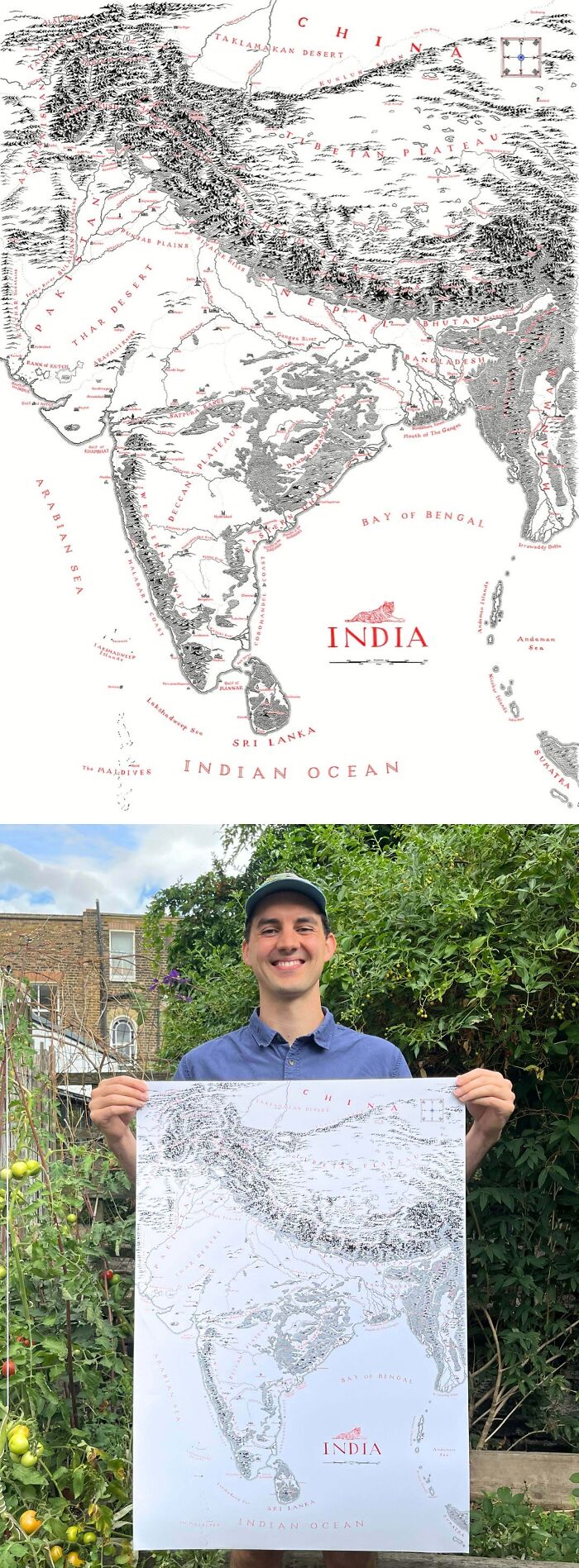
Image source: NACHODYNAMYTE
#2 A Logarithmic Map Of The Entire Observable Universe

Image source: 1Rab
#3 Map Of (Almost) Every Bus Route In The UK And Ireland
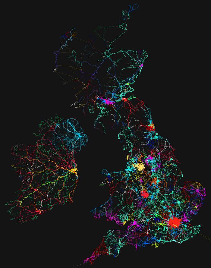
Image source: verum1gnis
#4 Europe’s Metal Powerhouses
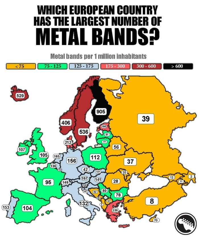
Image source: vladgrinch
#5 Map Of The Ocean Floors, As Published By National Geographic (1967 – 1971)
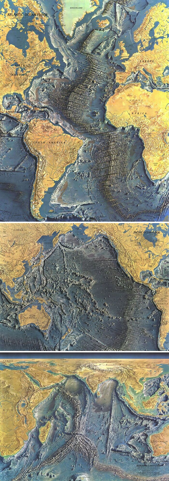
Image source: Milhaud
#6 Range Of European Bison (2020)
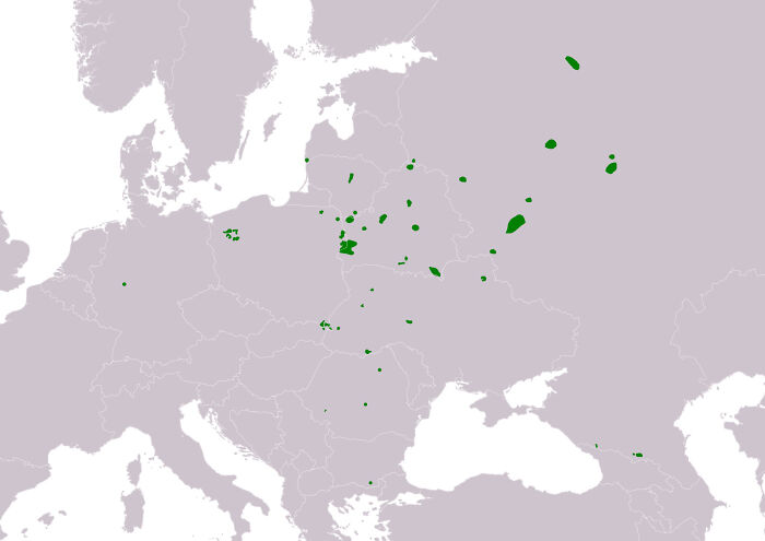
Image source: DistrictThen103
#7 Great Wall Of South America

Image source: Dry-Let-7718
#8 Countries Not Self Identified As Democratic
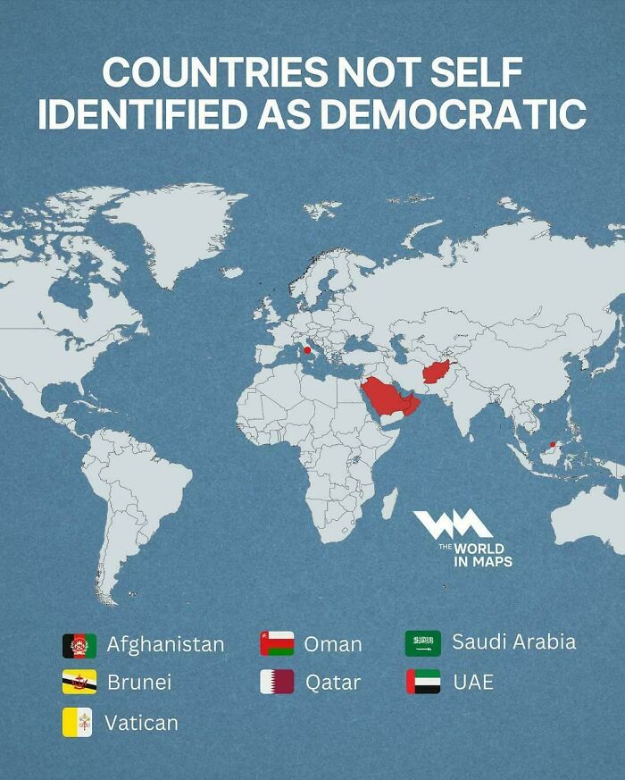
Image source: vladgrinch
#9 Share Of Cars Registered In 2024 In Europe That Are Full Electric
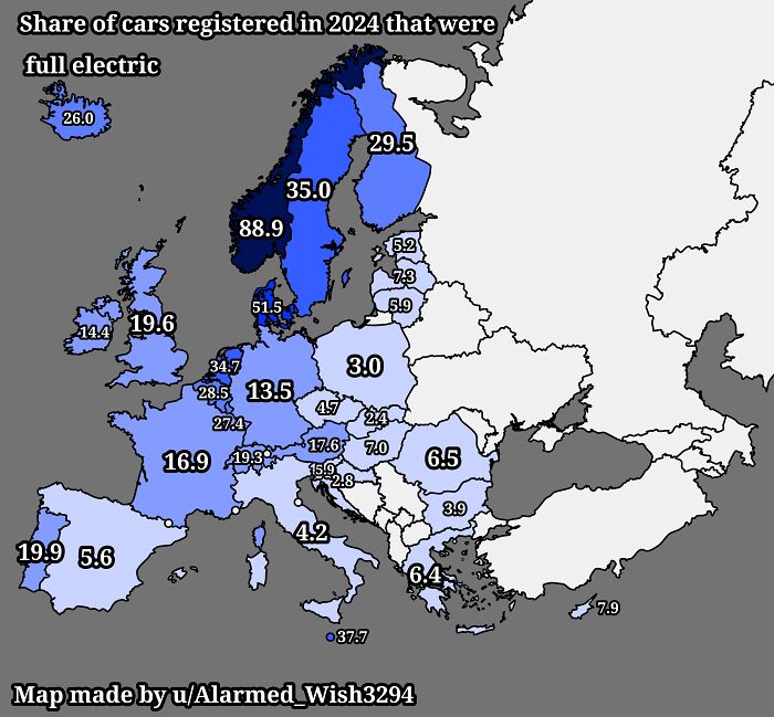
Image source: Alarmed_Wish3294
#10 Indonesia Laid Out Over Russia
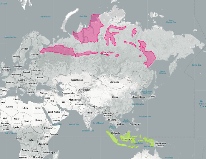
Image source: JoeFalchetto
#11 Australia Mapped By Its 1.3 Million Rivers, Streams, Tributaries
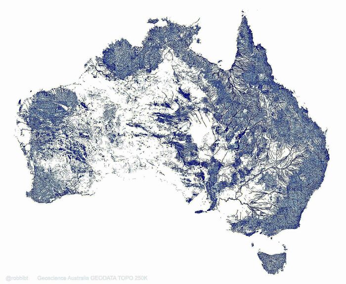
Image source: BufordTeeJustice
#12 This Is What Google Maps Looked Like On Launch Day In 2005
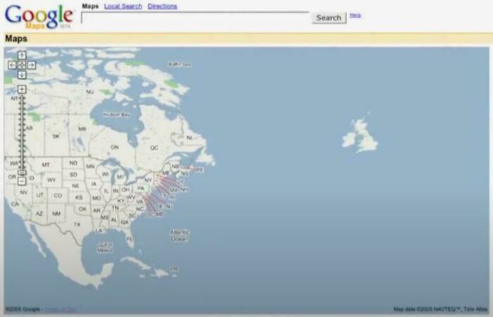
Image source: Mackelowsky
#13 Dog Ownership In Europe
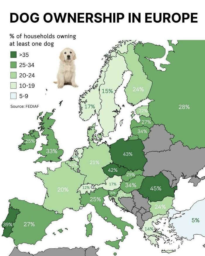
Image source: Mindful-Commander
#14 Soil Quality In Europe
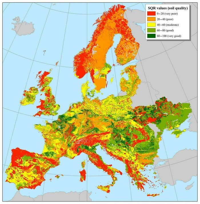
Image source: vladgrinch
#15 Mobile Screen Time In Hours Per Day (2024)
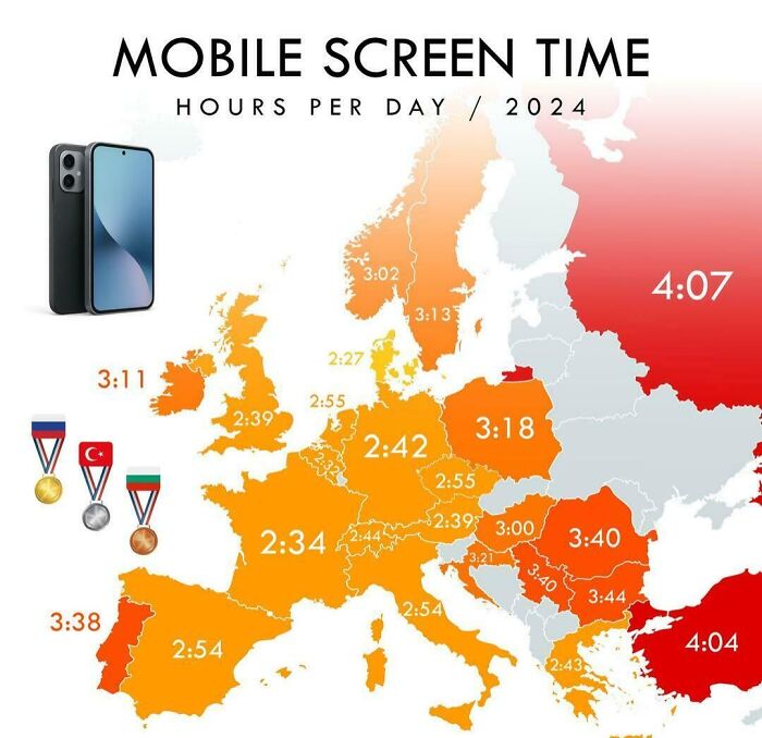
Image source: vladgrinch
#16 Does Google Maps Consider Your Country To Have A Fixed Border?
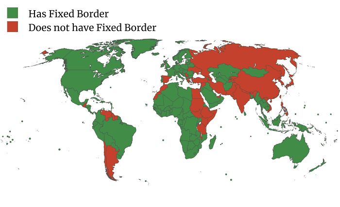
Image source: ReindeerAvailable575
#17 Some Of The Many Languages Spoken In Mexico

Image source: Simple_Pension_1330
#18 Europe 21,000 Years Ago, During The Last Ice Age
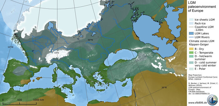
Image source: Utturkce249
#19 Polish–lithuanian Commonwealth At Its Maximum Extent Over Modern Borders
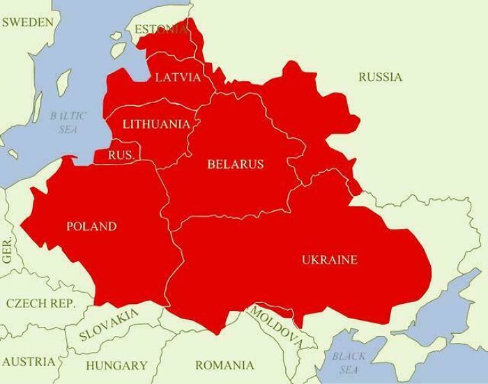
Image source: vladgrinch
#20 Map Of The Distribution Of Ugric Languages
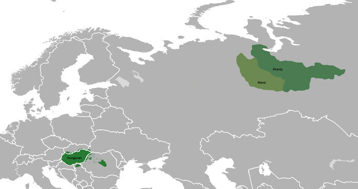
Image source: Grasshorse500
#21 The Collapse Of The Soviet Union : Most Countries Declared Their Independence In 1991

Image source: vladgrinch
#22 How Rich Is Bavaria Compared To The Rest Of Europe?

Image source: vladgrinch
#23 Muslim Majority Regions In The Balkans
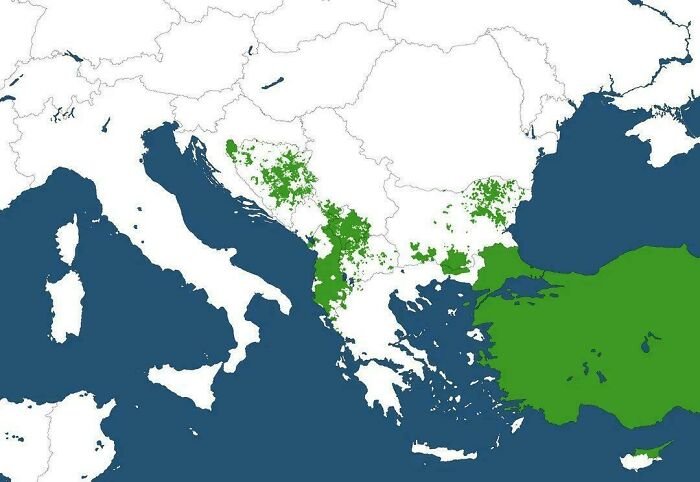
Image source: vladgrinch
#24 Countries Where Dinosaur Fossils Have Been Found
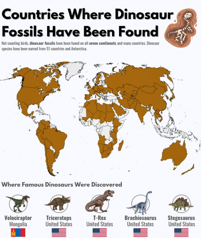
Image source: Calm_Astronomer3884
#25 Predominant Languages In Switzerland By Area And Share Of Speakers
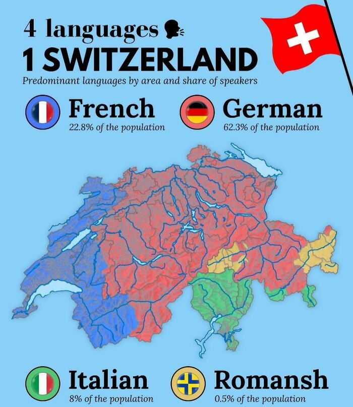
Image source: vladgrinch
#26 East German Map Of Berlin, 1988 – West Berlin Is Missing, As It Wasn’t Part Of The German Democratic Republic
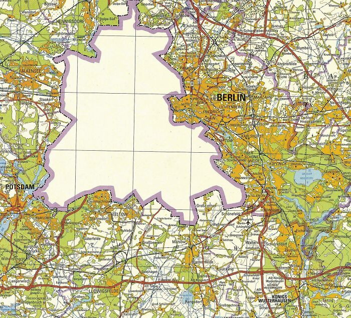
Image source: biwook
#27 The Most Common Occupational Related Surnames In Europe
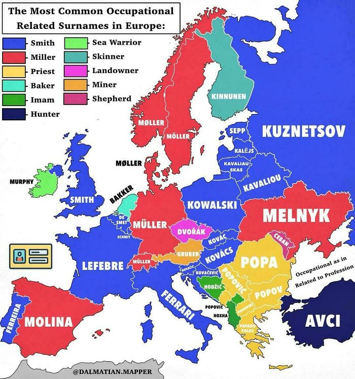
Image source: vladgrinch
#28 Share And Number Of Foreign-Born Population In Western European Countries
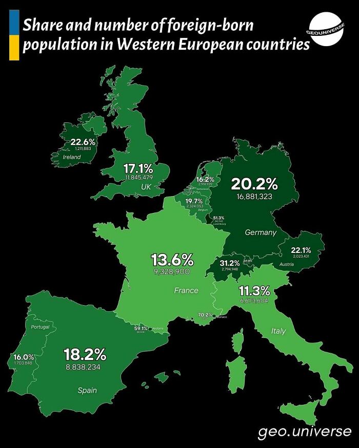
Image source: vladgrinch
#29 All The Roads In Canada (Posted By Col. Chris Hadfield On Fb)
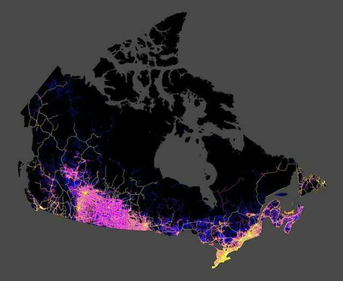
Image source: nthensome
#30 Parts Of Antarctica Claimed By Countries
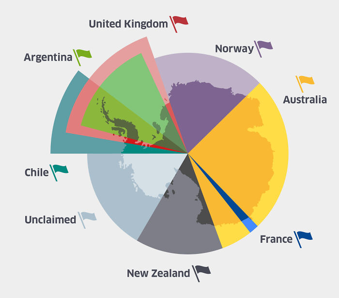
Image source: JulioFranz
#31 Top 3 Languages Taught In Australian School By State Or Territory
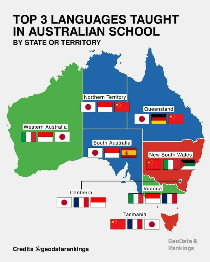
Image source: vladgrinch
#32 Best And Worst Us States By Overall Well-Being
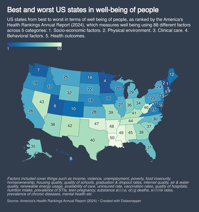
Image source: _crazyboyhere_
#33 Density Of Pig Farms Across Europe
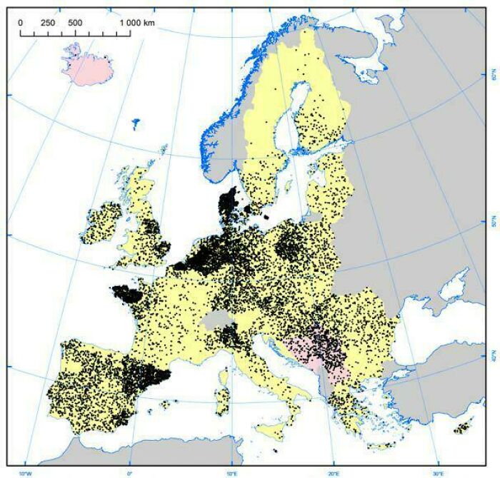
Image source: vladgrinch
#34 Map Of Heavens-Above.com Visitors, Showing Mirrored Anti-Continents Due To People Inputting Their Coordinates With The Wrong Sign
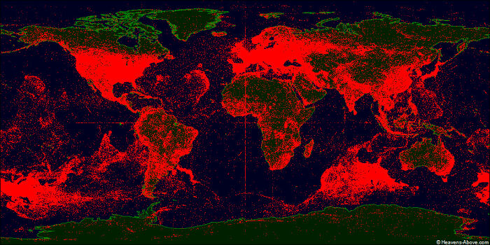
Image source: derekcz
#35 The Global Spread Of The Practice Of Ululation
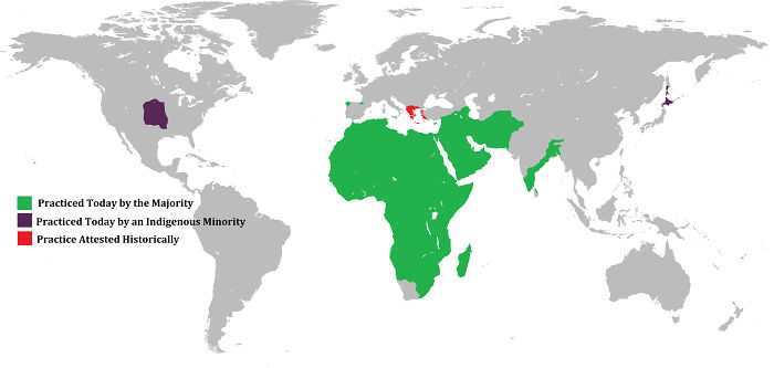
Image source: R120Tunisia
#36 What Americans Call Shopping Carts

Image source: cookoutenthusiast
#37 How Americans Get To Work
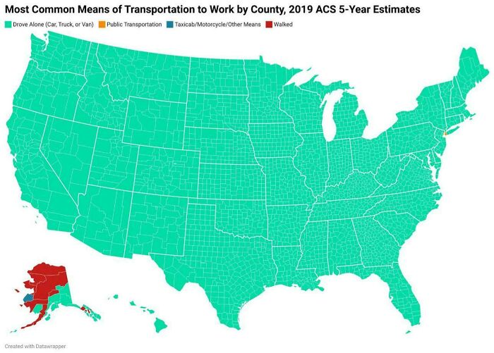
Image source: PowaStrokah
#38 Metro Areas In The USA Where More Than 5% Of Population Uses Public Transit To Get To Work
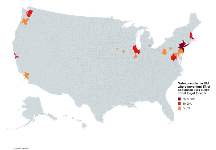
Image source: Simple_Pension_1330
#39 Willingness To Donate An Organ After Death In Europe
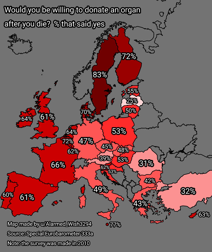
Image source: Alarmed_Wish3294
#40 Percent Of People Over 25 Who Have Completed High School In The Us
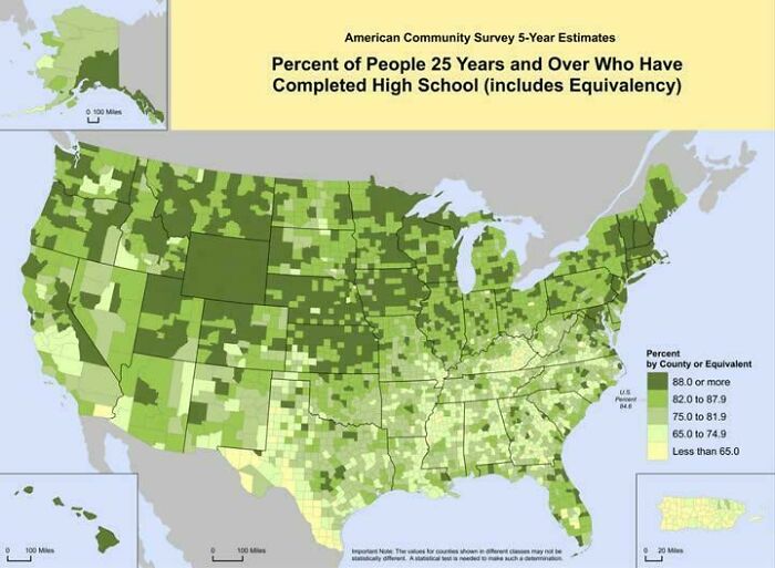
Image source: vladgrinch
#41 [oc] Approximation Of India’s Continental Divide
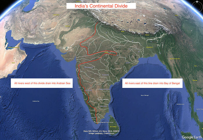
Image source: pm_me_your_target
#42 Homophobia Around The World
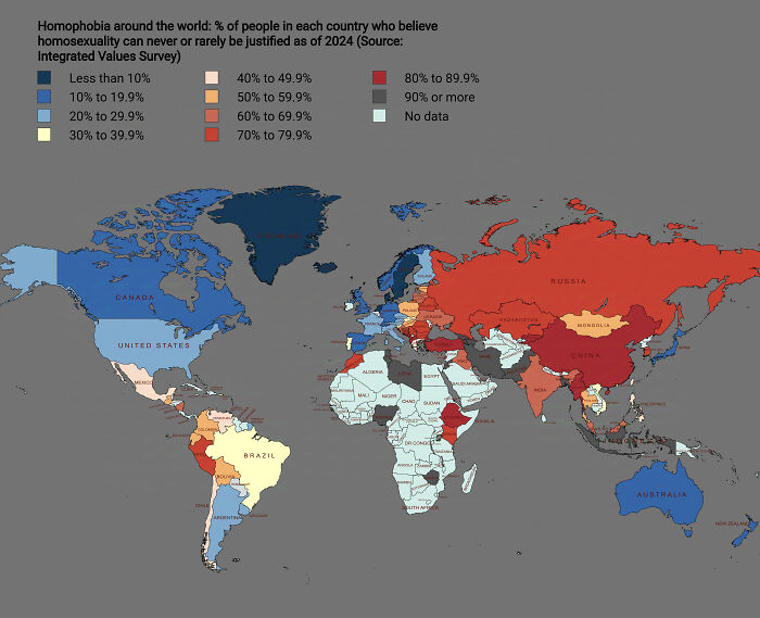
Image source: _crazyboyhere_
#43 How The Seasons Affect Iraq’s Greenery Over The Months
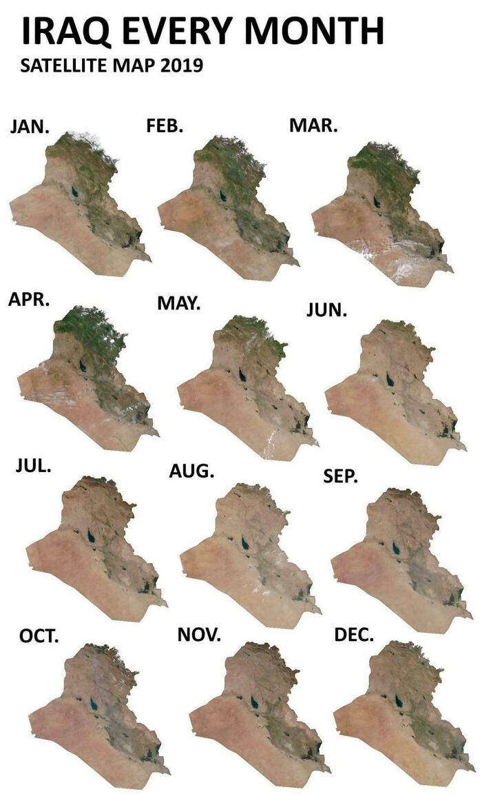
Image source: Assyrian_Nation
#44 Protien Intake vs. Height Above 6ft In India
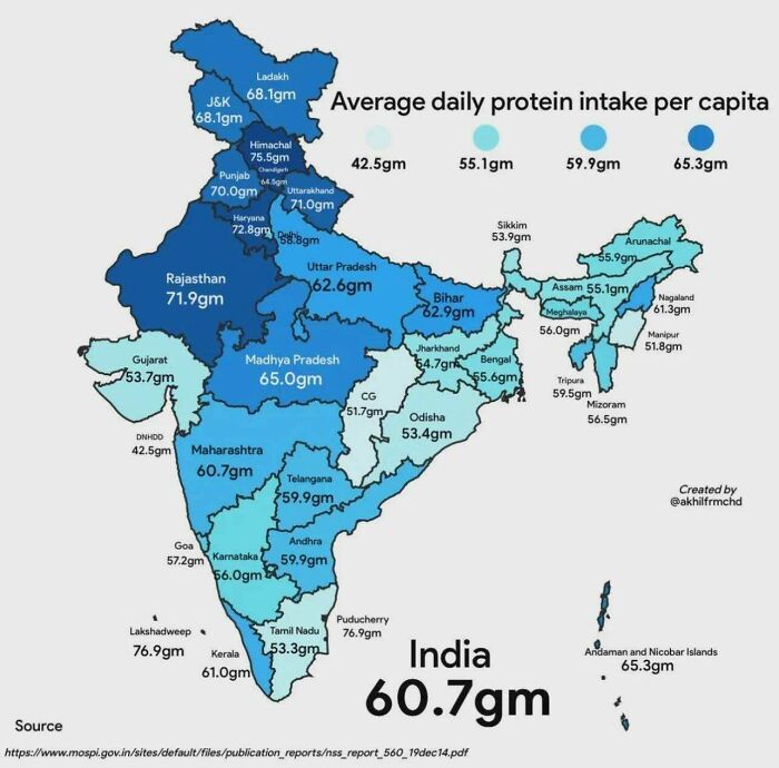
Image source: Soupchow1
#45 The Largest European Ports In Terms Of Annual Cargo Tonnage (In Millions Of Tons)
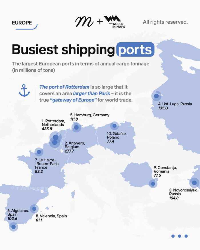
Image source: vladgrinch
#46 The Kakhovka Reservoir Then And Now
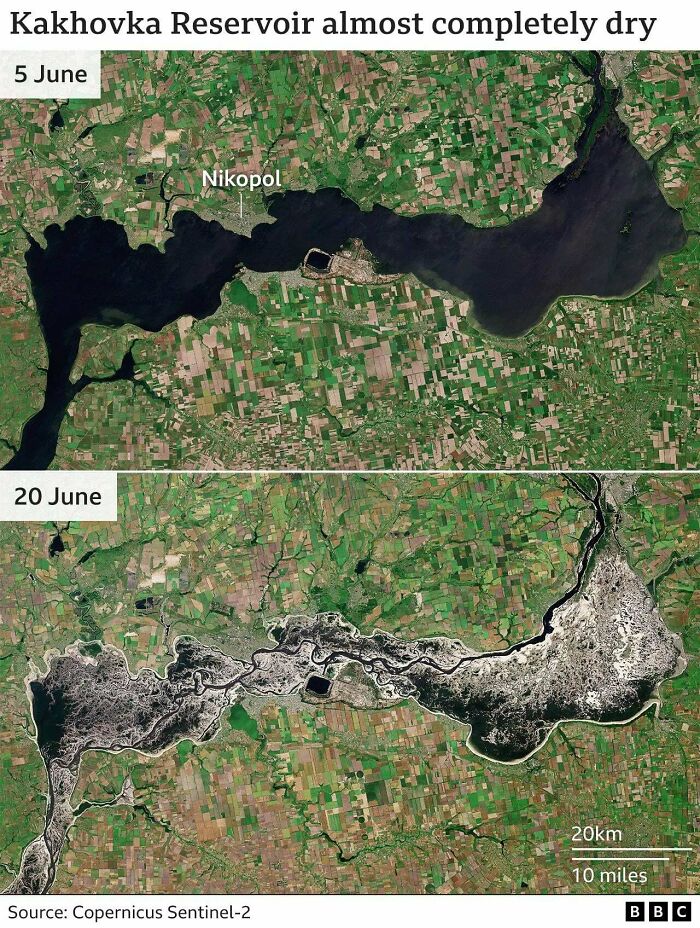
Image source: SummerAlternative699
#47 Change Of The Amount Of Jewish People Compared To Pre-Ww2 (Europe)
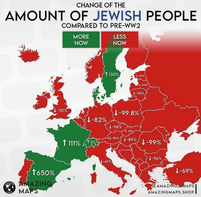
Image source: Wise_Ad8474
#48 The Roman Empire At His Peak 117 A.d
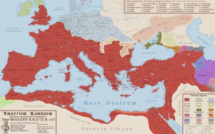
Image source: summus_rex_etruriae
#49 Treaty Of Alcáçovas, The World’s First Colonial Partition Treaty
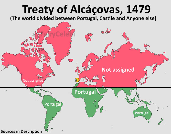
Image source: FairyCelebi
#50 This Area Has Produced Every Waterpolo Olympic Champion Since 2000
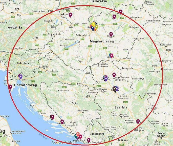
Image source: cooliocoe
#51 Annual Precipitation In Germany In 2024
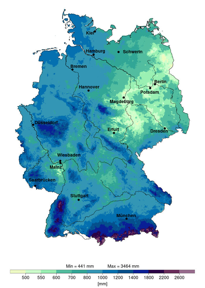
Image source: ExternalMethod6825
#52 Official Map Of The Argentine Republic
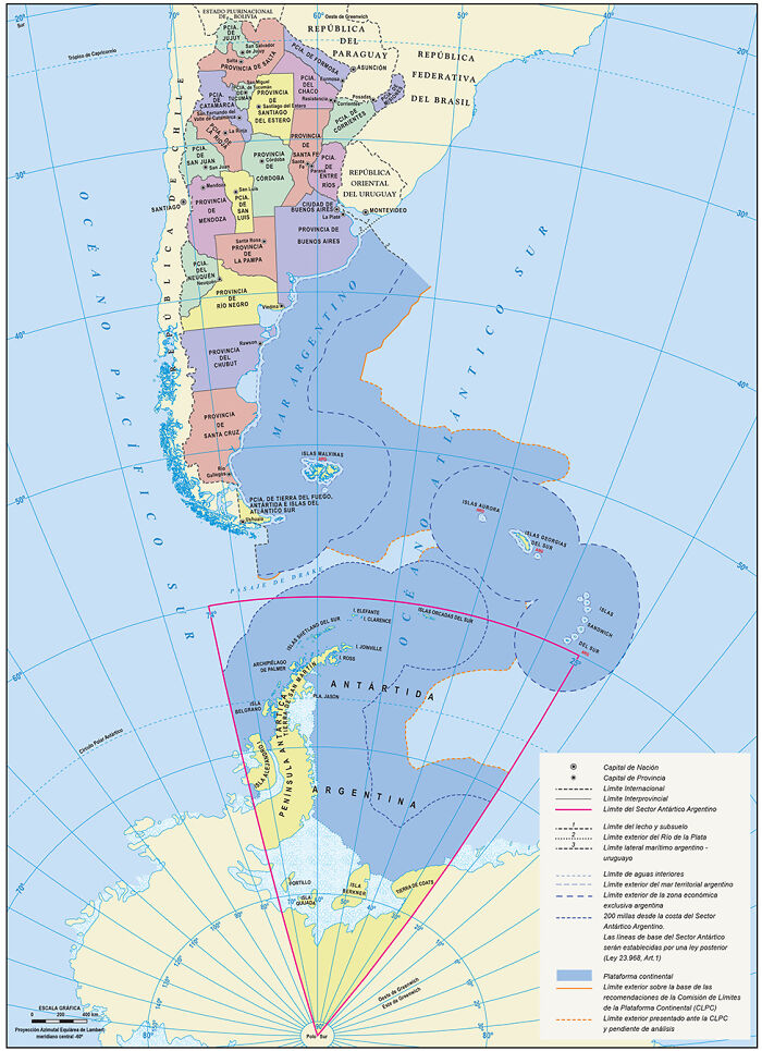
Image source: Argentinotriste
#53 Map Of European Territories By The Number Of Years Spent Being Part Of France
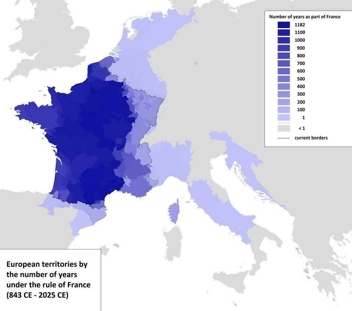
Image source: vladgrinch
#54 Topographic Map Of Ukraine
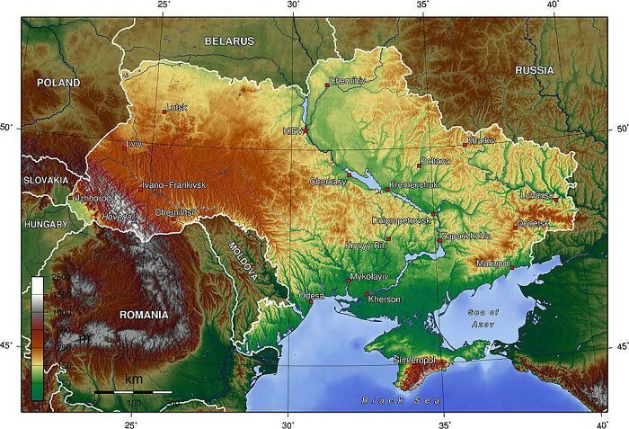
Image source: vladgrinch
#55 The Woolly & Columbian Mammoth’s Range At Their Peak
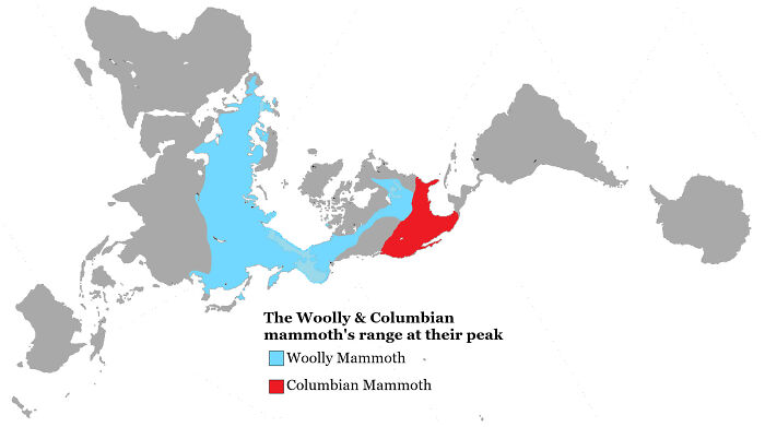
Image source: Simple_Pension_1330
#56 Aldi Equator In Germany
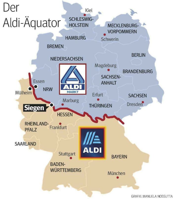
Image source: Public_Research2690
#57 Legal Status Of Conversion Therapy For Minors In The Us
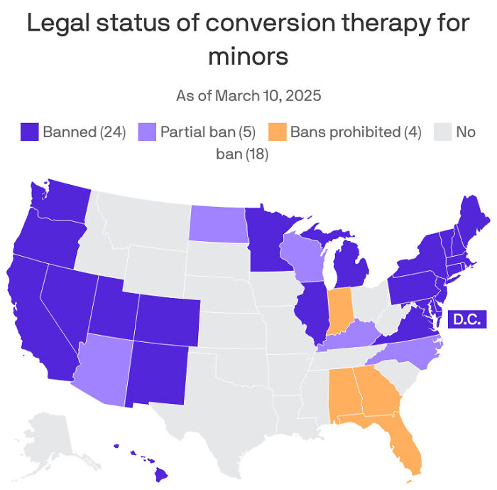
Image source: Heretostay59
#58 Who Wants To Join The Eu?
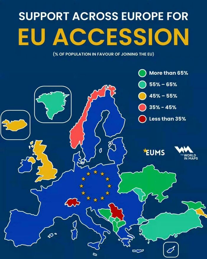
Image source: vladgrinch
#59 Country Outside Southeast Asia That Wants To Join Asean
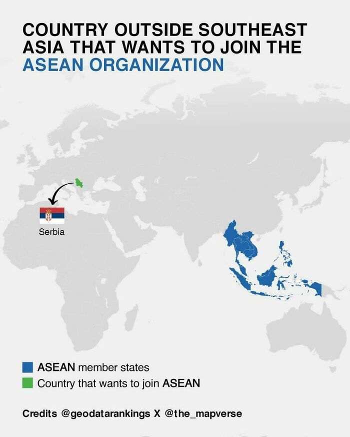
Image source: vladgrinch
#60 Percentage Of People Optimistic About The Future Of The Eu
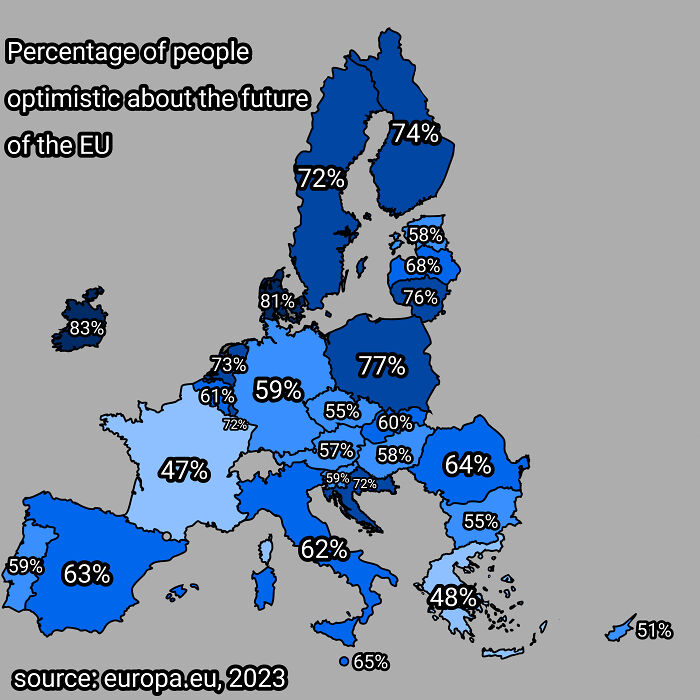
Image source: Alarmed_Wish3294
#61 Percentage Of Population Paying Income Tax [2024]
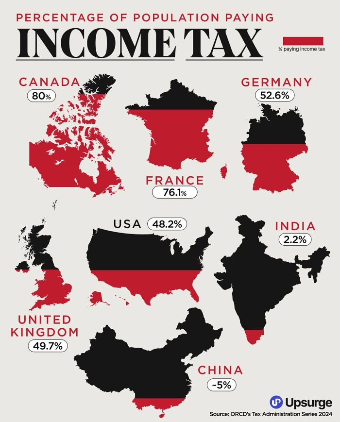
Image source: Mundane-Laugh8562
#62 Average European Internet Speed By Country In 2024
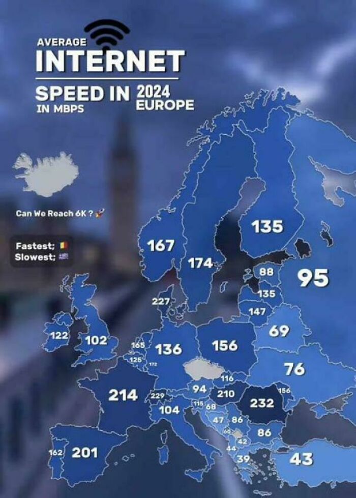
Image source: vladgrinch
#63 The World Divided In 2 Equal Parts Of Population
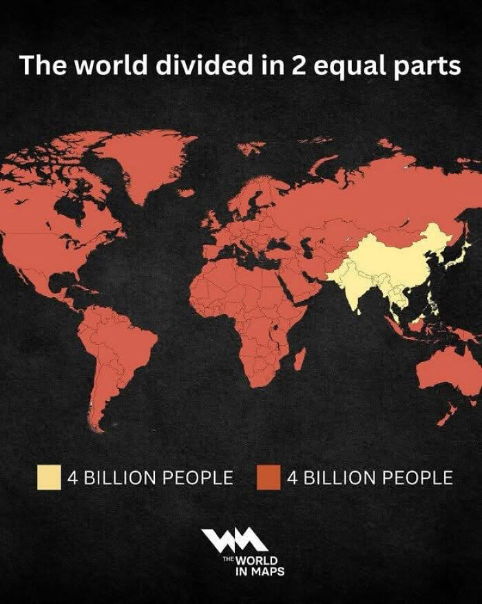
Image source: Twunkorama
#64 Germany’s Economy Equals All Of These Countries Combined (2024)
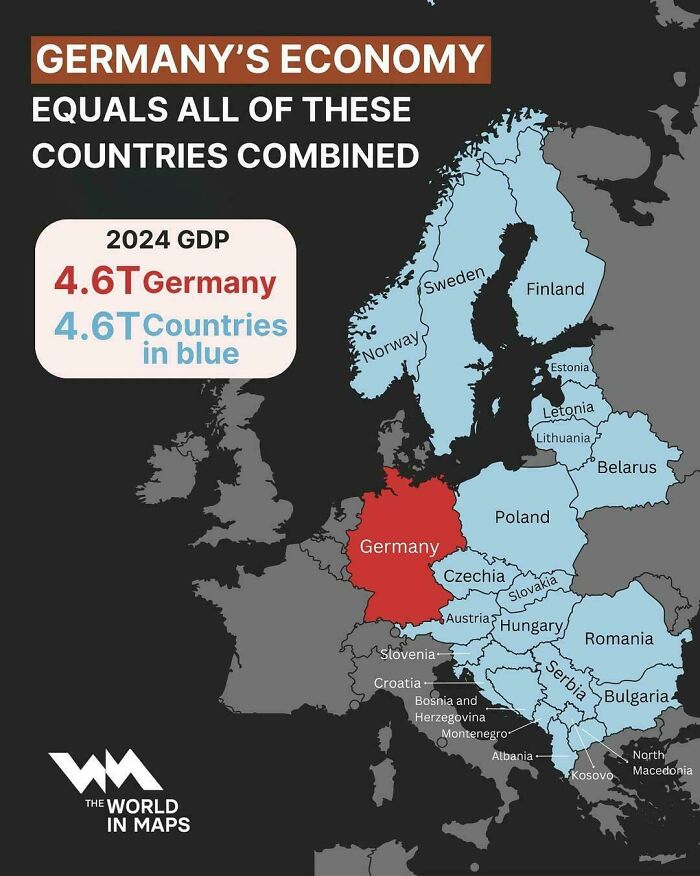
Image source: vladgrinch
#65 Chinese American Population By County, 1870
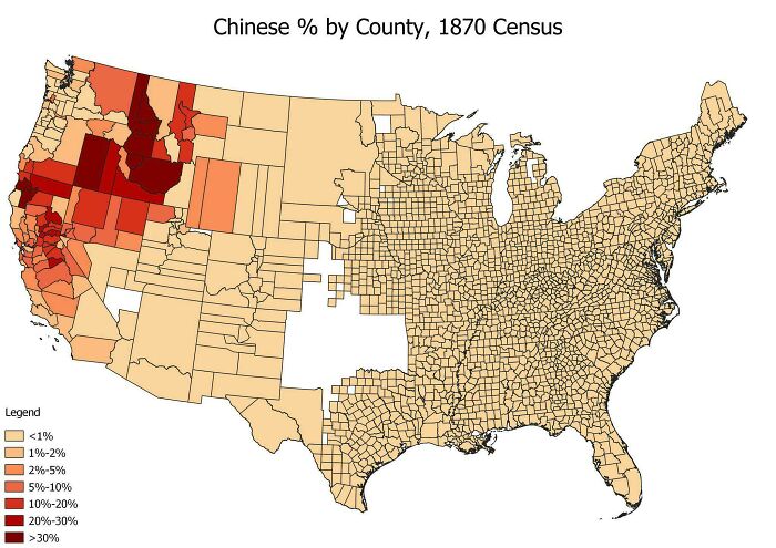
Image source: RedHeadedSicilian52
#66 Mexico City Engulfing Lake Texcoco From The 16th Century To 2000
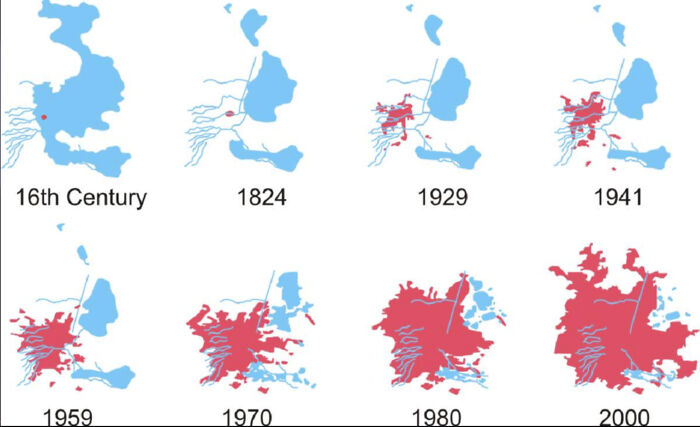
Image source: Old-School8916
#67 How Many Spouses Must Attend For A Marriage To Be Valid?
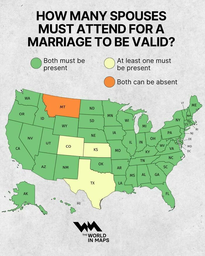
Image source: vladgrinch
#68 Fort Wayne, In – Centrality To Major Cities
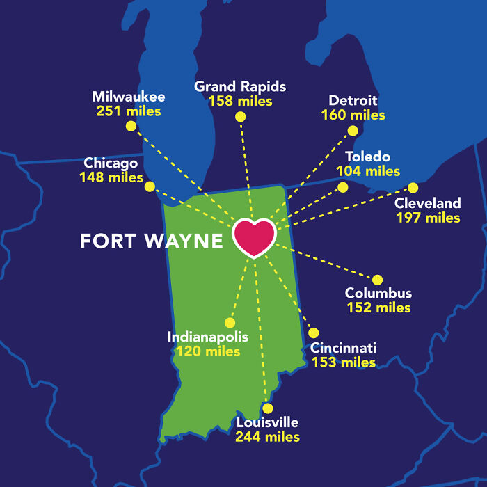
Image source: sarnobat
#69 Population Density Of The World In A Unique Way
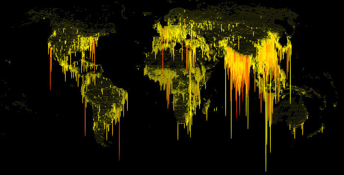
Image source: Separate-Box-9181
#70 Who Should Join The Eu Next?
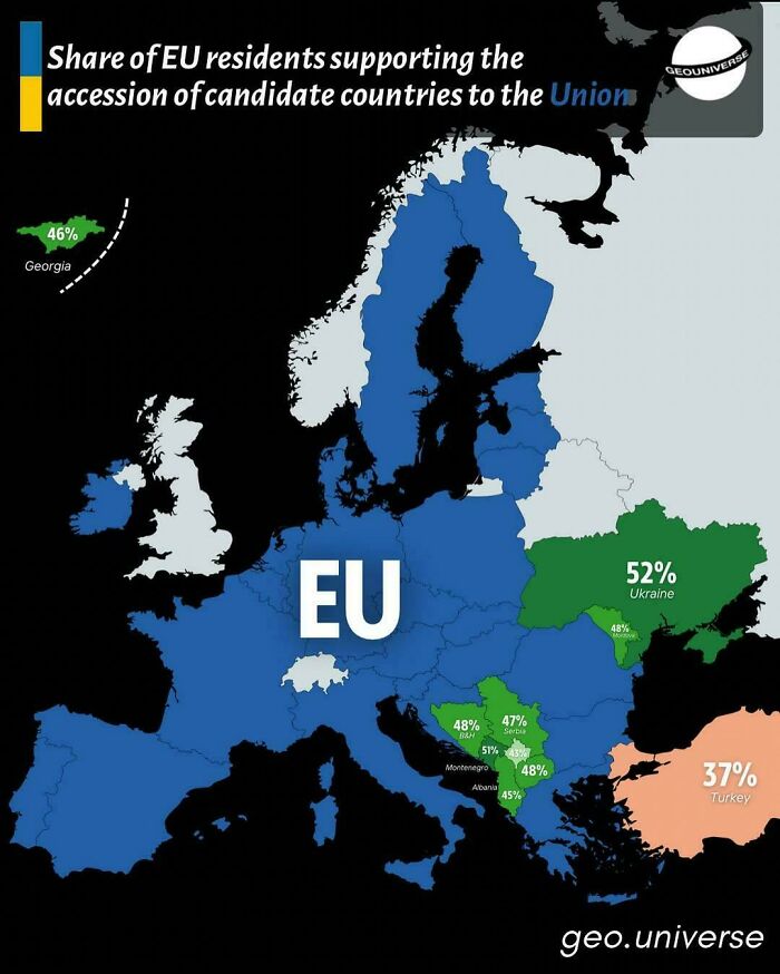
Image source: vladgrinch
#71 The Biggest Empires In History
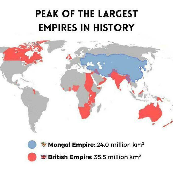
Image source: HolyTamrah
#72 What Africa Might Look Like In 10 Million Years
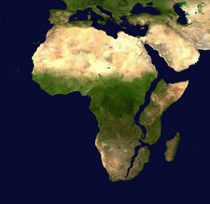
Image source: vladgrinch
#73 What Americans Call Driving Around In Circles
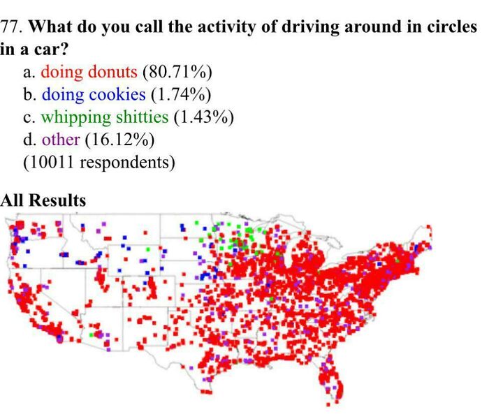
Image source: cookoutenthusiast
#74 Indian States Compared To Countries By Land Area
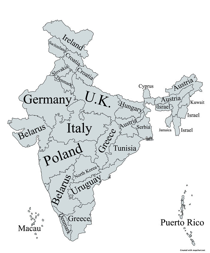
Image source: SuperYoman100
#75 The Fall Of +38 Calling Code
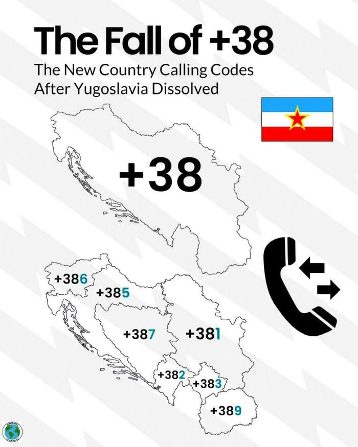
Image source: vladgrinch
#76 America’s Humidity Belt
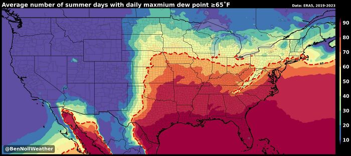
Image source: vladgrinch
#77 White American Population 1790-2020 (Swipe)
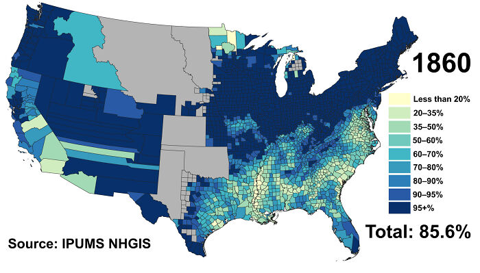
Image source: CombinationTime8064
#78 Map Of Arabic Language Expansion Between 540 And 2022

Image source: vladgrinch
#79 Rank Of Volkswagen In Car Sales, Europe, 2024
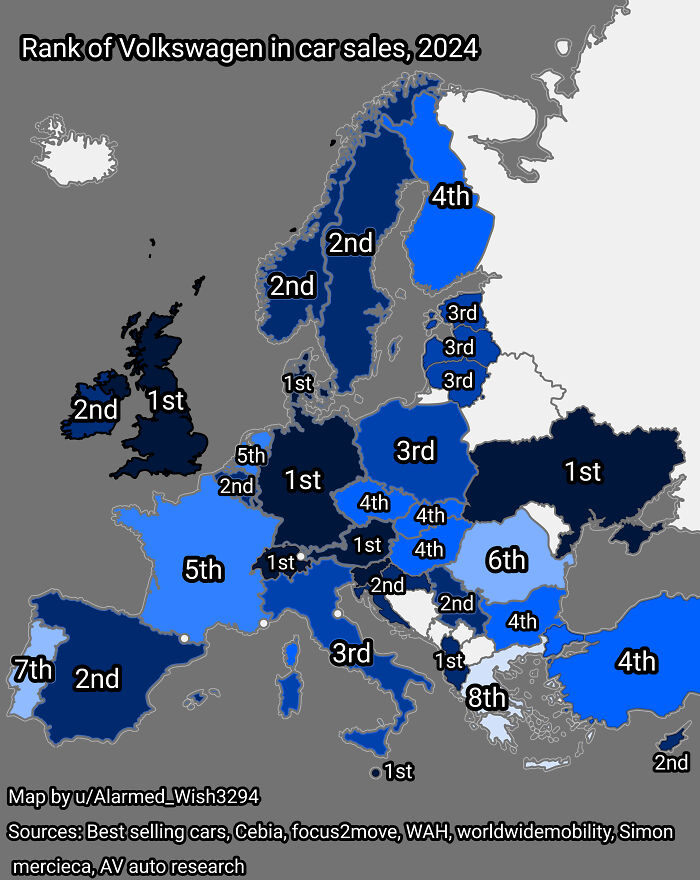
Image source: Alarmed_Wish3294
#80 The United Ecoregions Of America
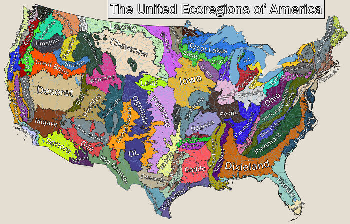
Image source: Bradinator-
#81 Most Common Ethnicity Of White Americans By County
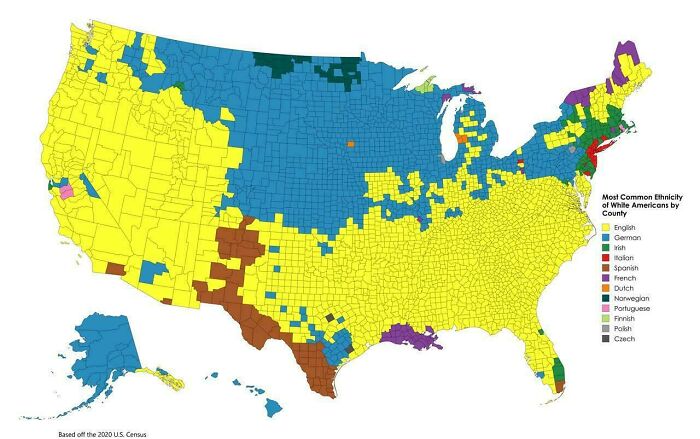
Image source: _Giulio_Cesare
#82 Norway Overlaid On The Us
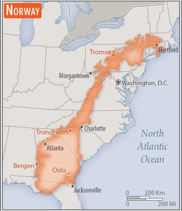
Image source: plaev
#83 Half Of The World’s Rice Is Produced In 2 Countries
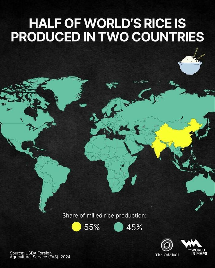
Image source: vladgrinch
#84 The Bro Map Of America
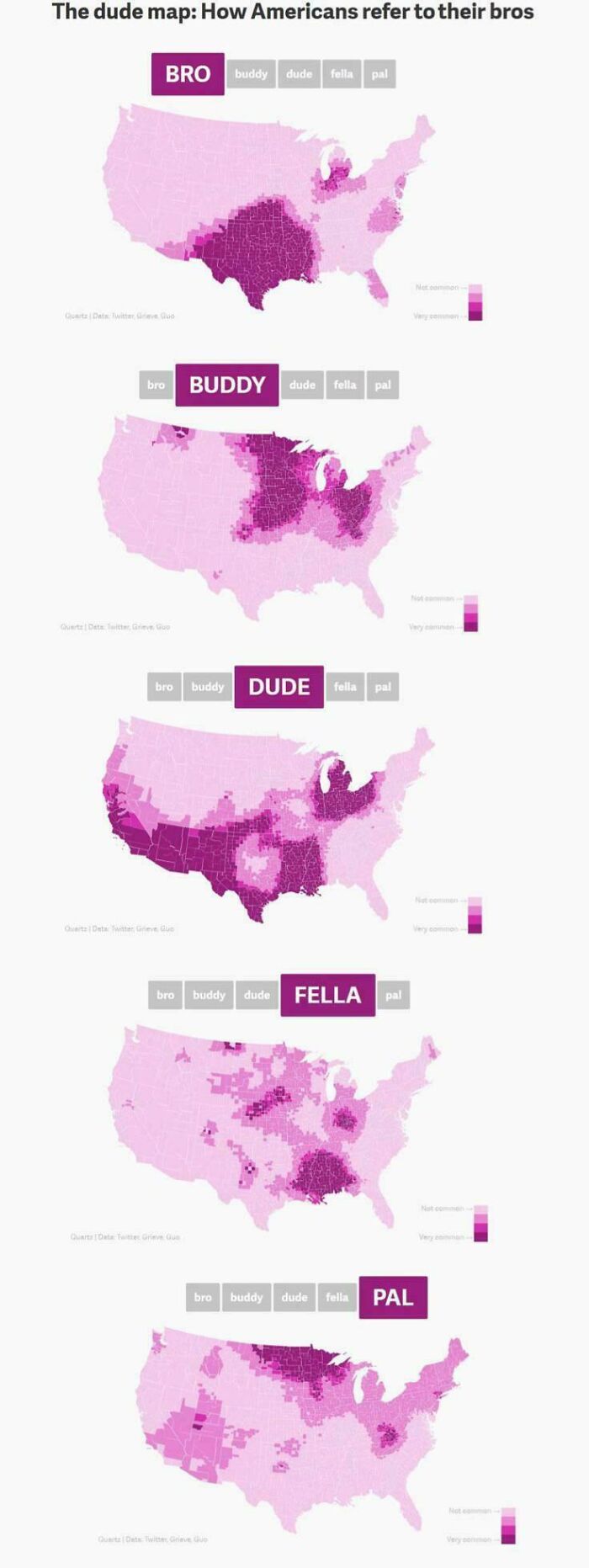
Image source: vladgrinch
#85 How Many Electoral Votes Every State Would Gain/Lose If They Were Proportional To Population
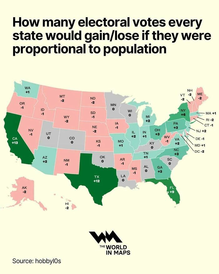
Image source: vladgrinch
#86 China’s Economy Is Bigger Than The Combined Economies Of All The Asian Countries In Red
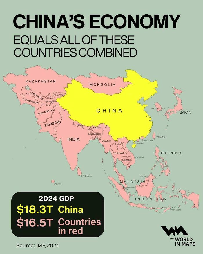
Image source: vladgrinch
#87 Despite The Housing Shortage, In 85% Of San Francisco Bay Area, It Is Illegal To Build Anything Aside From Single Family Houses
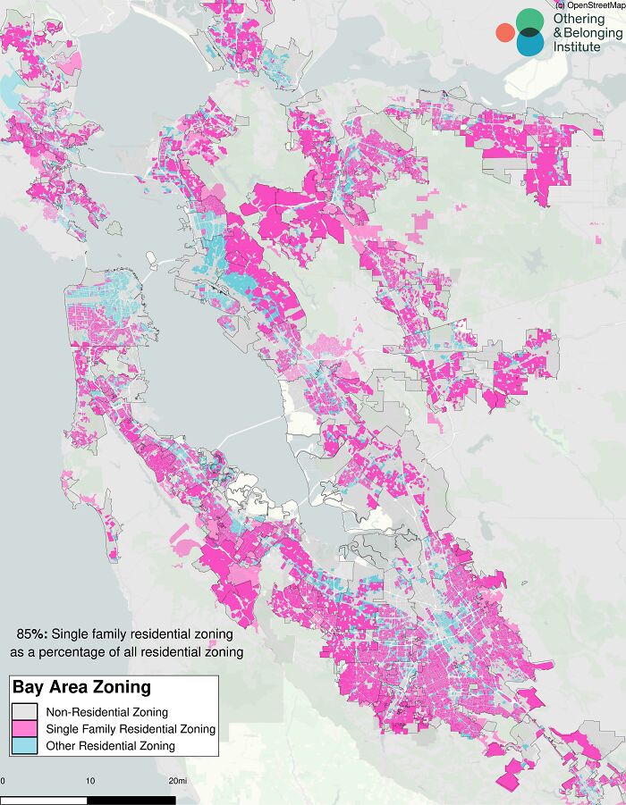
Image source: Mongooooooose
#88 Nunavut Is The Largest Electoral District On Earth (8 Times Larger Than The UK)
Image source: vladgrinch
#89 Bougainville, Soon To Be The Newest Nation In The World On September 2027
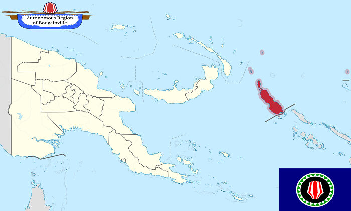
Image source: APrimitiveMartian
#90 Eastern Ukraine Exactly One Year Ago vs. Today
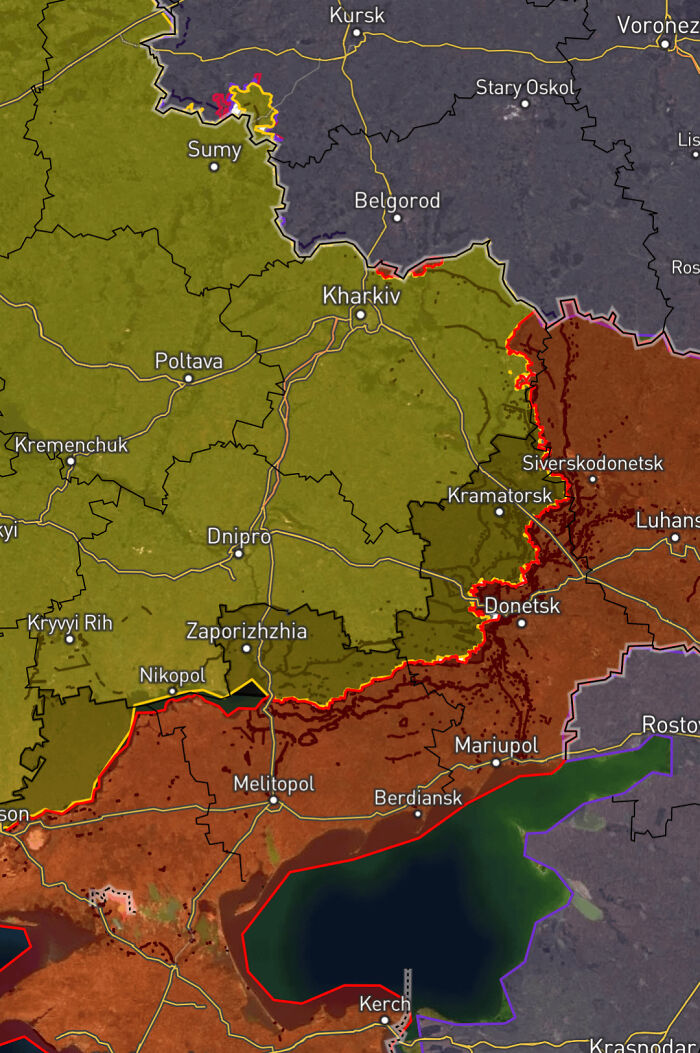
Image source: CreativeStrain89
#91 Aldi Nord vs. Aldi Sud
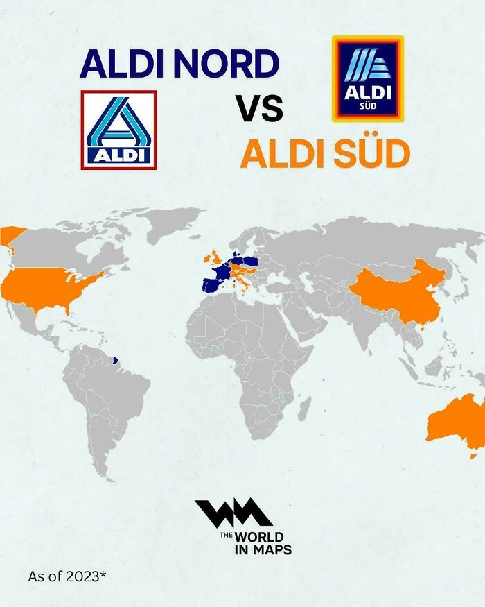
Image source: vladgrinch
#92 Election In New York 1892 vs. 2024 Showing Just How Much NY Politics Have Changed
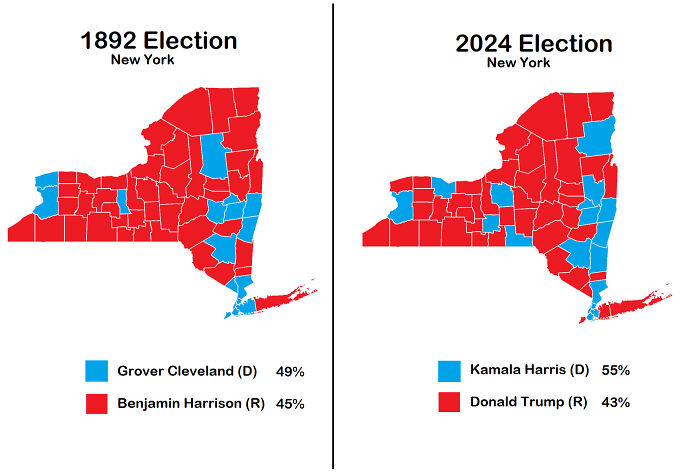
Image source: PotsdamDefamation
#93 The Red Area Is Home To Around 60% Of Icelanders, Despite Covering Just 1% Of The Land
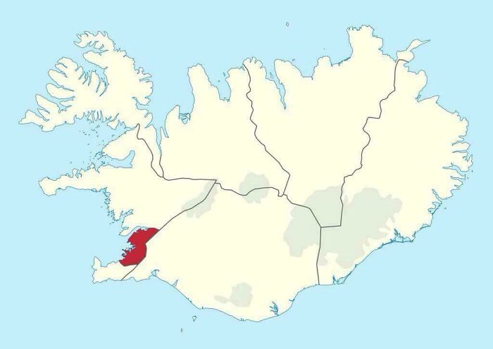
Image source: vladgrinch
#94 Countries With A Lower Gdp Per Capita Than Mississippi
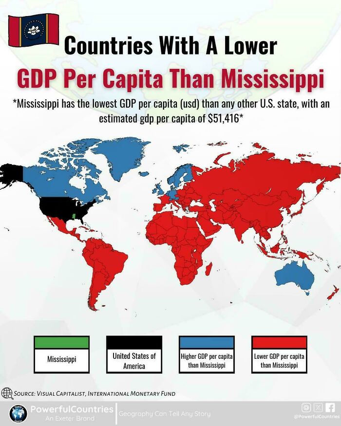
Image source: vladgrinch
#95 Alphabets Of The Balkans
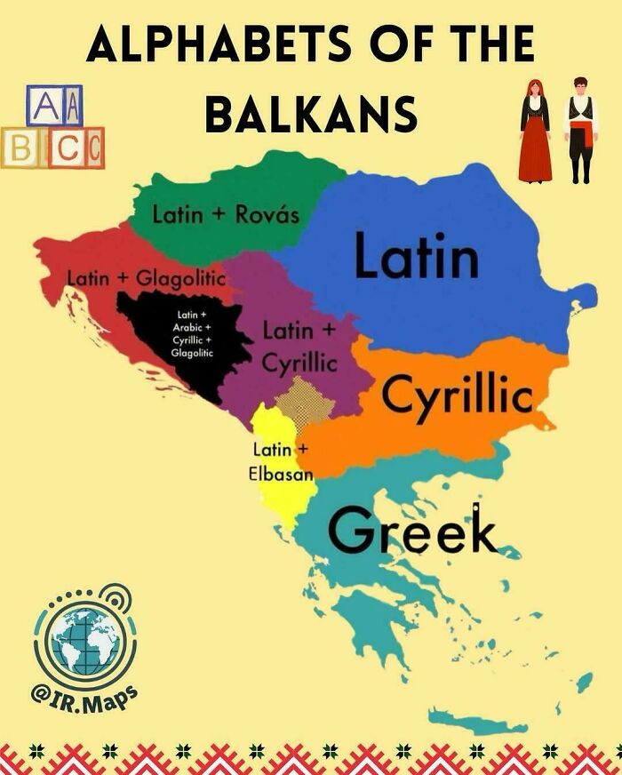
Image source: vladgrinch
#96 Identified Settlements In 16th Century Palestine
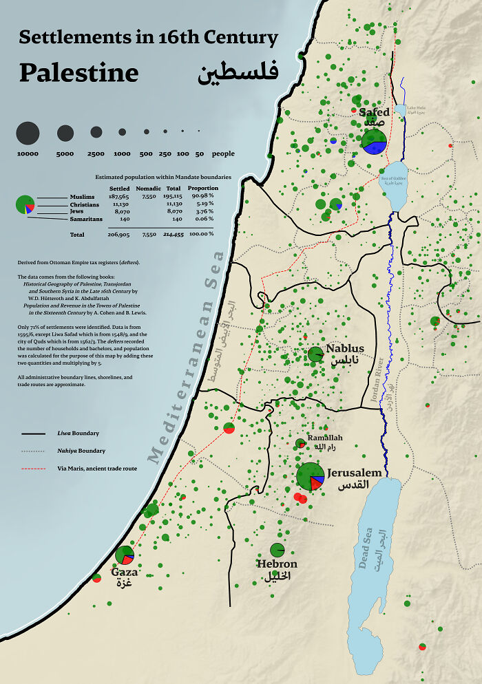
Image source: mzrvtfni
#97 Largest Religion In Each Canadian Electoral Area
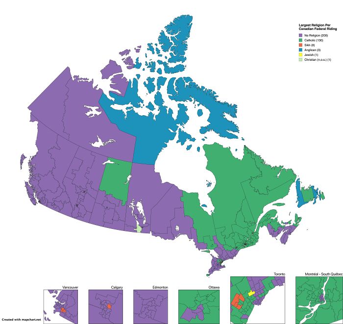
Image source: MongooseDear8727
#98 Largest Religion By District In India
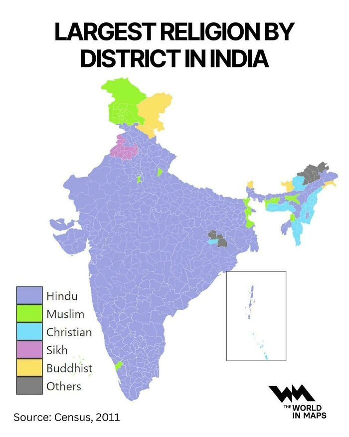
Image source: vladgrinch
#99 Africa Is Humongous
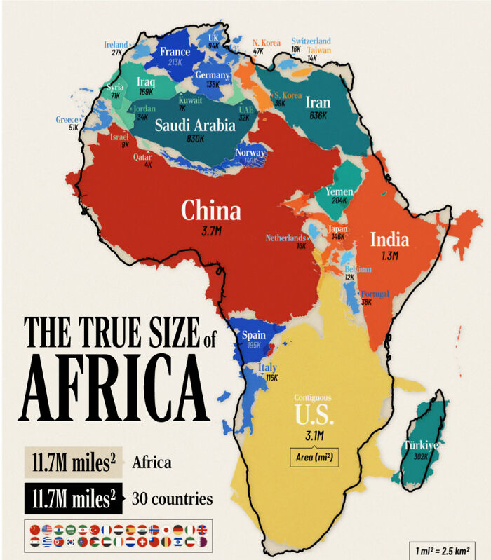
Image source: GamingDisruptor
#100 Poster Of The 2025 German Bundestag Election Results

Image source: Intelligent_Bowl_656
#101 Limburg
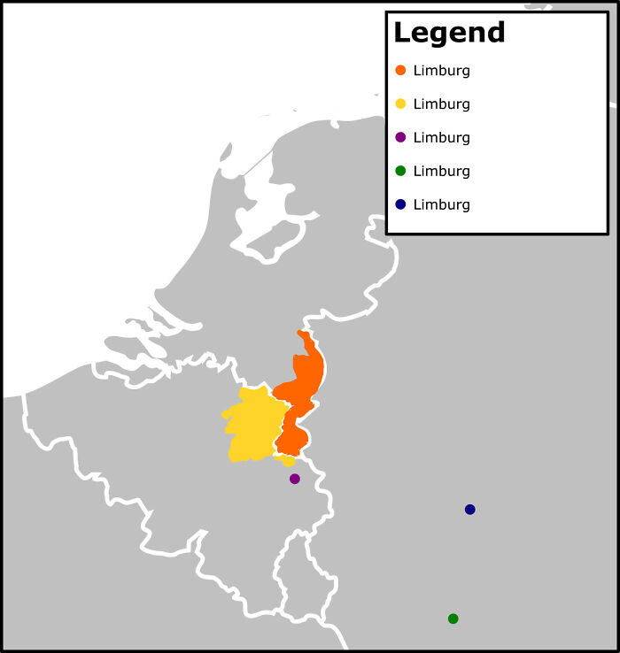
Image source: midnightrambulador
#102 2024 Most Viewed Soccer Teams In Each Us State
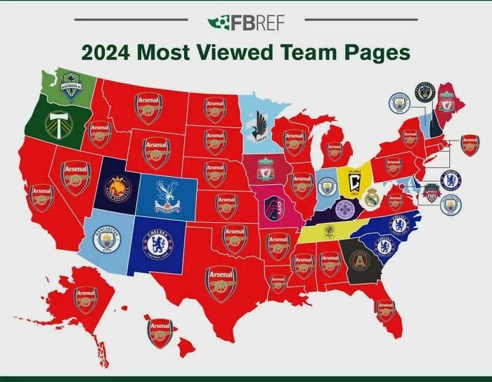
Image source: Critical_Mountain851
 Follow Us


